The Curious Case of USS McCain

By

Vice Admiral (retd.) Vijay Shankar

Vulnerabilities of computerized warship systems to cyber-attacks: the albatross around the operational Commander’s neck.

On 21 August 2017, in the darkness of astronomical twilight, a destroyer USS John S. McCain bound for Singapore after a sensitive ‘freedom-of-navigation’ operation off one of China’s illegal man-made islands in the South China Sea, collided with a 30,000 ton, oil and chemical tanker ‘Alnic MC’, in the Eastern approaches to Singapore. Ten sailors lost their lives in the collision while the hull of the ill-fated McCain, was stricken by a large trapezium-shaped puncture on its port quarter abaft the after stack. The greater base of the trapezium was below the waterline and extended at least 40 feet along the hull to a height of 15 feet. Two months earlier a similar collision involving another Arleigh Burke destroyer could advance a more-than-accident theory.

Initial reports suggest loss of course keeping control caused the McCain’s fatal collision. That, and the computer aided nature of the ship’s steering and navigation system, has led to the conjecture that McCain’s manoeuvring system may have been “hacked” into and then manipulated to force a deliberate collision.

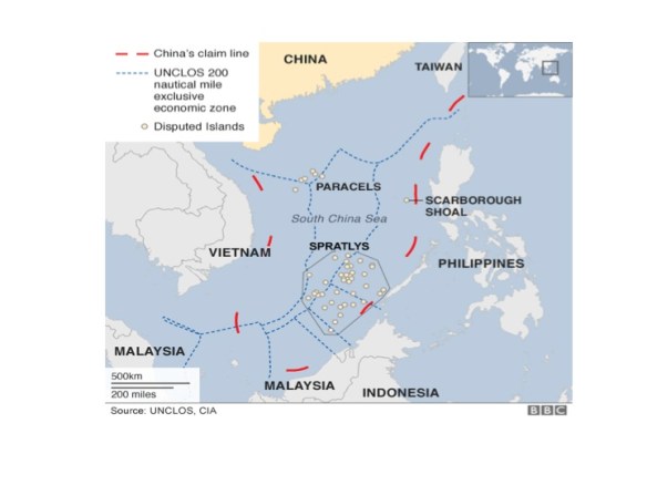
The Singapore Strait extends between the Strait of Malacca and the South China Sea in the east. The strait is about 8 nautical miles (15 km) wide and lies between Singapore Island and the Riau Islands (Indonesia) to the south. It is one of the world’s busiest shipping routes. The Port Authority of Singapore periodically warns mariners of the special rules applicable for safe pilotage in these waters. In its marine circulars (#20 of 14 November 2006) it draws attention to the traffic separation scheme (TSS) and the hazardous character of these waters. By law, the significant burden placed on vessels is: to proceed in the appropriate traffic lane in the general direction of flow; to keep clear of traffic separation lines or zones; cardinally, masters of vessels are warned to take extra precautions and proceed at a safe speed. In determining safe speed, experience advocates several factors be considered which in addition to traffic density include: state of visibility, manoeuvrability of the vessel, state of wind, sea and current, proximity of navigational hazards and draught in relation to the available depth of water. In the circumstance, the prudent mariner very quickly appreciates that the primary hazard presented by the narrows is not geography, but density of traffic and the perils of disorderly movement. On an average 200-220 ships transit this passage daily of which more than 100 are restricted in their ability to manoeuvre due deep draught.

The organisation on board a warship for negotiating such waters are the Special Sea Dutymen; a group of highly specialised and trained personnel charged with manning critical control positions involved in evolutions that potentially could endanger the ship, such as berthing, transiting pilotage waters and close-quarter manoeuvring. The key is the instancy of human judgement and failsafe control.

A standard fit on most USN warships is the Integrated Platform Management Systems (IPMS). It uses advanced computer-based technology comprising sensors, actuators, data processing for information display and control operations. Its vital virtue is distant remote control through commercial off the shelf elements (some may argue “its critical vulnerability”). Modern shipping, for reasons of economy and only economy, was quick to adopt the system. Warships systems, however, demand redundancy, reliability, survivability and unremitting operations; all of which militate against cost cutting expediencies. Incidentally, the Indian Navy, as early as May 1997, introduced the IPMS as a part of Project ‘Budhiman’ with the proviso that it would not intrude into critical control and combat functions.

It is not entirely clear the extent to which the IPMS had penetrated systems on-board the USS McCain but in the last two decades it is well known that USN has resorted to deep cuts in manpower and heavily invested in control automation. Inferences are evident.

On 21 August nautical twilight was at 0618h (all times Singapore standard) the moon was in its last quarter and moon rise at 0623h, it was dark, however, visibility was good and sea calm. Collision occurred at 0524h; USS McCain was breached on the port side causing extensive flooding. Examination of the track generated by the Automatic Identification System (AIS) video indicates the Alnic MC approaching Singapore’s easternmost TSS, about 56 nautical miles east of Singapore, at a speed of 9 knots when it suddenly crash stops and turns hard to port, which we may assume was the result of the collision. Unfortunately, military vessels do not transmit AIS data, so we do not have the track of the McCain. However, since the McCain was headed for Singapore it is reasonable to assume that she was overtaking the slow tanker from the latter’s starboard side when she lost steering control and effected an unbridled turn over the tanker’s bulbous bows. The trapezoid form of the rupture and elongation aft would suggest events as mentioned rather than a north south crossing by the destroyer at the time of collision (after all destination was Singapore).

Coincidentally, two Chinese merchantmen the Guang Zhou Wan and the Long Hu San were in close proximity through the episode; so, was that a chance presence? Or does it add to the probability of deliberate cyber engineering of the mishap? And, why else other than to damage the strategic credibility of the US Navy deployed in tense conditions in the South and East China Sea. Or was it, indeed, a case of gross crew incompetence? While, time and ‘sub-rosa’ inquiries could put to rest speculations, vulnerabilities of highly computerized warship systems to cyber-attacks may well remain the albatross around the operational Commander’s neck.

The Scorpene’s Sting

by

Vice Admiral (retd.) Vijay Shankar

(This article was first published in The Wire, http://thewire.in/64410/the-scorpenes-sting/)

Submarines are anomic platforms of stealth, concealment and lethality. Each of these mortal attributes is integrated in the body of the weapon to form a very efficient and secretive marauder from the deep. The early years of deployment gave vent to some unsavoury remarks about the use of this weapon; most uncharitable was Admiral Sir Arthur Wilson’s outburst on the submarine: “…underhand…and damned un-English…treat all submarines as pirates…and hang all the crews.” But this perhaps echoed a visceral fear of the unknown rather than any sense of morality. A century later, the submarine’s tactical advantage remains its capability to use the medium to hide, to strike and then to hide again in waters that firstly complicates and then frustrates detection. To a target within its strike radius it continues to generate the same primeval anxiety that made Sir Arthur quiver.

To appreciate fully the impact of the more than 22,000 page leak of design parameters of the French Direction des Constructions Navales Services’  (DCNS, French naval defence company) Scorpene submarine being built in India for the Navy, one must first come to grips with the problem associated with combating modern conventional submarines such as the Scorpene. The aim of anti-submarine warfare (ASW) is to deny the enemy effective use of his submarines. This can be achieved by adopting tactical as well as material measures. The former is achieved through intelligence gathering, surveillance, detection and localising the submarine before destroying it with stand-off weapons that permit the hunter to remain out of the kill range of the submarine. It involves adopting doctrines for co-ordinated operations, setting up dispositions that inhibit freedom of submarine manoeuvre, and tactics that trap it into a ‘destruction-zone.’ Material undertakings, on the other hand, are largely driven by advances in technology that keep platform design, sensors and weapons in a progressive state of change that enhance effectiveness in ASW operations. Marriage of intelligence, efficient tactics and resourceful doctrines with capabilities of contemporary sensors and weapons lies at the core of successful anti-submarine operations. Within this framework, for intuitive foreknowledge to be confirmed by information leakage boosts both probabilities of submarine detection as well as kill.

Anti-submarine operations begin with establishing a submarine probability area. This area is based on intelligence or on inputs from wide area surveillance networks which include remote sensing satellites and sea-bed sensors; and indeed it may be based on electronic or capability indiscretions (surfacing, use of active sensors, communications etc.) of the target submarine. The search phase which involves a systematic and continuing investigation of the area then commences. The area may be demarcated to confirm the absence of a submarine or the search may be launched to locate and destroy it; in the latter instance it is centered on a datum that is based on the last or best known position of the target submarine. Choice of scouts is determined by search rate and degree of vulnerability to submarine counteraction; for obvious reasons ‘time-late’ at datum is a critical factor that can enlarge the search area to an extent when probability of detection diminishes geometrically as it follows an ‘inverse cube law.’ For this reason the preferred scouts for ASW are anti-submarine aircrafts using sensors such as sonars, sonobuoys, magnetic anomaly detectors, radar and infra-red sensors. Inherent in the detection concept is sensor ‘sweep width’ which uses a definite detection law—no probability of detection outside specified range capability, while targets within the specified range are detected with increasing probability. Clearly, successful operations are critically founded on knowledge of enemy capabilities, the specification of adversary weapons and sensors, combat systems, acoustic signature, magnetic profile, and infra-red characteristics. Thoroughness of search, technically termed as the ‘coverage factor,’ is heightened if operating parameters along with design features of the submarine are known.

 Planning an anti-submarine search is a complex craft. It is based on the search theory and the discipline of operations research, both of which were born at the same time and indeed share a common lineage: the necessity of securing the survival of allied naval shipping against submarine attacks during World War II. Passage of time has not changed the need, though ASW is conducted differently today than in World War II, search techniques used in ASW have potentially remained unchanged in concept, structure, and application. Where changes are apparent is in the use of advanced analysis methods and data processing systems using computers, wide area networks and data bases with provision for processing, identification and cueing located ashore. Target characteristics form an important consideration in modelling, for simulation and combat preparation. The first determination in planning and deploying ASW searchers is the probability of contact necessary for accomplishment of the mission from which is obtained the coverage factor. Armed with this and knowing the sweep width of the sensor to be used, scouts are disposed at mathematically determined spacing and move along computed tracks such that early detection is rapidly followed by localization and destruction. This theoretically is how ASW works, but in the real hydrosphere many factors remain unknown. ASW is a complicated warfare discipline, and proficiency can only develop through extensive simulation and training. Destroying a submarine is the hardest task in naval warfare; it can never be the submariners’ case to make this task easier.

Somewhere nestled in those 22k compromised pages, there is certainty of a small section that outlines the Scorpene’s operating “Tactical and Technical Parameters” which is the distillate of all those many thousand folios. And herein lies the rub. We have noted in previous paragraphs (at some length) the various considerations that go into an adversary mounting a search, localizing and then prosecuting a submarine and how ready availability of specifications that answer these considerations largely increases the efficiency of the search-and-destroy operations. They in addition provide critical inputs required for computer modeling and simulating the manoeuvring and operating characteristics of the Scorpene. All this simplifies classification and confirmation of a detected contact. Even to the uninitiated reader it must now be substantially clear that what has been provided on a platter is the ability to generate a computer based virtual reconstruction of the vessel. This ‘cybernetic Scorpene’ can be played with over and over again on a simulator in a variety of hydrological and meteorological scenarios till sensor operators and tacticians gain a very high degree of proficiency in recognizing and fingerprinting the noise, magnetic, electromagnetic and infra-red signatures under all conditions of machinery loading across the entire spectrum of speeds and operating depths. So now the question that begs to be answered is: has the Scorpene lost its sting?

 Investigations are currently in progress to establish just how the leak occurred and to what ends the information found its way to the public domain. There is no clarity why the leak took the tortuous route of passing from the hand of a “disgruntled” DCNS employee through two unknown South East Asian agencies where a fourth hand is alleged prior to falling into the disc drive of the associate editor of The Australian from where it cascaded into the public domain. While reasons for the leak may be many ranging from incompetence at DCNS, cyber hacking by mala fide parties to cut-throat antagonism and resentment between competitors (Japan, Germany) at the loss of the $ 50 billion new design Short fin Barracuda submarine contract for the Australian Navy to DCNS; clearly the strategic beneficiaries of this significant disclosure are the Chinese and Pakistan Navies.

In the meantime, understandably, the Indian Navy have gone into damage control mode. Besides the enquiry that has been launched, it would be in the fitness of things that they also constitute a Special Operations Research Group that begins with two premises: firstly, that compromise has occurred and secondly, that major design changes to the ‘Scorpene’ are not practicable (at least not for the first block if at all there is to be a second). The Special Operations Research Group may then be mandated as follows:-

  • Establish what specific tactical capabilities have been compromised.
  • Device signature masking and spoofing techniques through material and tactical measures.
  • Adopt innovative manoeuvring and operating profiles that stretches and provides permutations to its operating envelope.
  • Ensure that crew turn around is such that expertise aggregates.
  • Identify clauses in the Scorpene contract that have been violated by the leak and replace them with instruments that oblige DCNS to accommodate material alterations that may be warranted to fulfil the mandate of the Special Operations Research Group without prejudice to contractual liabilities of DCNS.

Some portions of the Scorpene’s invisibility cloak may indeed have fallen off in the recent episode, but its brain and sting-lethality remains as potent as was. To regenerate its combat effectiveness may well mean to re-invent operating profiles and devising astute masking techniques. This no doubt is a tough ask, yet by no means beyond the capabilities of the professional savvy of the Indian Navy; there is only one caveat, keep DCNS in a response-only mode.

South China Sea: China’s Double Speak and Verdict at The Hague

By

Vice Admiral (retd) Vijay Shankar

When Premier Xi rubbished the 12 July 2016 verdict of the International Permanent Court of Arbitration at The Hague on China’s claims over most of the South China Sea, what exactly was meant? For no international justice system had thus far ever called China to order for its expansionist strategy.

What the Hague had in fact done was not only to uphold the case filed by the Philippines in 2013, after China seized a reef in the Scarborough Shoal; but also condemned China’s conduct in the South China Sea over construction of artificial islands and setting up military infrastructure. In an unequivocal rebuke, it found China’s expansive claim to sovereignty over the waters had no legal basis, historical or otherwise. The verdict gives motivation to the governments of Brunei, Indonesia, Malaysia, Vietnam and Taiwan to pursue their maritime disputes with Beijing in the Permanent Court of Arbitration (PCA). Small wonder then is Premier Xi’s fulmination.

The central issue before the PCA was the legality of China’s claim to waters within a, so called, “nine-dash line” that appears on official Chinese charts. It encircles 90 per cent of the South China Sea, an area of 1.9 million square kilometres approximately equal to the combined areas of Afghanistan, Pakistan and Myanmar put together. Philippines contention was that China’s claims were in violation of the United Nations Convention on the Law of the Sea (UNCLOS), which both China and the Philippines have ratified. In its decision, the tribunal said any historic rights to the sea that China claimed “were extinguished” by the treaty. And its failure to be a party to the deliberations in no way bars the proceedings. The UNCLOS lays out rules for drawing zones of control over the world’s oceans and seas based on coastal orientation. While the concept of Historic Waters means waters which are treated as internal waters where there is no right of innocent passage.

As far as the “nine-dash line” (originally eleven-dash) is concerned; following the surrender of Japan in 1945, China produced a proprietorship chart titled “Position of the South China Sea Islands” that showed an eleven-dash line around the islands. This map was published by the Republic of China government in February 1948. It did not hold onto this position after it fled to Taiwan. The Chinese Communist Party, however persisted with this cartographic notion, modifying the 11 to 9 dashes when in 1957, China ceded Bailongwei Island in the Gulf of Tonkin to North Vietnam.

Map: The Nine-Dash Line  Slide1

Source: BBC.CO.UK

The PCA concluded that China had never exercised exclusive authority over the waters and that several disputed rocks and reefs in the South China Sea were too small for China to claim control of economic activities in the waters around them. As a result, it found, China outside the law in as much as activities in Philippine waters are concerned. The tribunal cited China’s construction of artificial islands on the Mischief Reef and the Spratly archipelago as illegal in addition to the military facilities thereon which were all in Philippine waters.

The episode has besmirched the image of Xi Jinping, his politburo and indeed the credibility of the Communist Party of China (CPC). Tolose their legal case for sovereignty over waters that they have heavily invested in must come as a rude shock to their global aspirations. A complaisant response may set into motion the unravelling of the CPC’s internal hold on the state as defence of maritime claims is central to the Communist Party’s narrative. Any challenge to this account is seen in Beijing as a challenge to the Party’s rule. But the die has been cast; it remains to be seen how more regions and neighbours respond to China’s unlawful claims wherever it is perceived to exist. An indication of the regional response was Vietnam’s immediate endorsement of the tribunal’s decision.

Thus far China has responded sardonically with a typical Cold War propagandist style avowal “We do not claim an inch of land that does not belong to us, but we won’t give up any patch that is ours. The activities of the Chinese people in the South China Sea date back to over 2,000 years ago.” said the front-page in The People’s Daily, which ridiculed the tribunal as a “lackey of some outside forces” that would be remembered as a “laughingstock in human history.” Such dippy doublespeak has no place in contemporary geopolitics. For China to do nothing about the matter will be difficult in the extreme. It does not take a political pundit to note that some form of immediate coercive military manoeuvre in the South China Sea is in the offing. Also, it would hardly be realistic to expect China to scurry away to dismantle the military infrastructure it has so far set up; more likely it is their revisionist policies that would be reviewed.

Towards the end of the Cultural Revolution, in 1976, China brought out a movie titled “Great Wall in the South China Sea,” it was not about the inward looking narrative of Chinese civilization but of “expansive conquests that would knit together all of South East Asia.” The Hague’s verdict has grievously injured the latter strategy. And if the free world is to rein in China’s bid to rewrite the rule books including the right to unimpeded passage in the South China Sea then, it would do well to convince her of the illegitimacy of her position. In the meantime Indian diplomacy should promote the littorals of the South China Sea to seek arbitration for their maritime disputes with China at The Hague.